Import Shapefiles
Submitted by Mick on Mon, 2009-12-28 16:41.
::
To import shapefiles into RadioCompass you first need to make sure you have them in the following format (the later versions of ArcGIS do not use this format by default):
Projection: Geographic (Latitude/Longitude)
Datum: WGS84
Planar Units: Arc Degrees
Once the shapefile is in the proper format, you can begin the import process.
Open RadioCompass
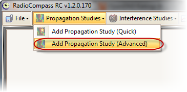
Go to Propagation Studies, Add Propagation Study (Advanced)
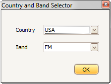
Choose a Country and Band, press OK
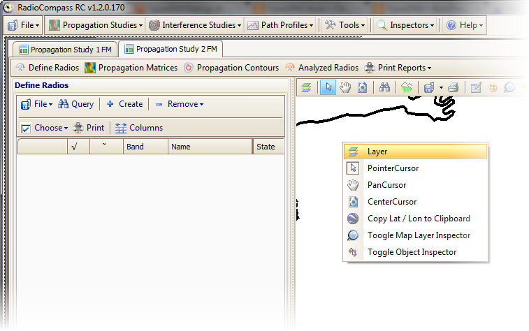
Right-Click on the map and choose Layer
Right-Click on Vector Layer and choose Setup Vector Data
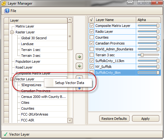
This screen is where you will choose your shapefile and what you wish its name to be.

You will need to restart RadioCompass for the changes to take affect.
- Login to post comments